I have a digital and a paper copy of a mining map of the North half of Stevens County in 1900. There is a lot of historical information on it about what the names of claims are, where they are and who owned them at the time. The downside is that the computer file is huge, 288 megs for the “small” version, and the paper copy is so much smaller than the original that you need a magnifying glass to read it. It is too big to load on and off the website. If you want a copy, contact me: Joe.Barreca@gmail.com
Panorama Gem
Rock Hounding in Northeast Washington
Posts by author panorama
Trip scheduled to Jim Creek
Here is word from Scot Jackson:
Marcus Ciderfest 2015
Naches Thundereggs
This gallery contains 23 photos.
Barter Fair 2015
This gallery contains 16 photos.
Comstock Mine
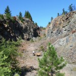
This gallery contains 15 photos.
Old Mining Book Online
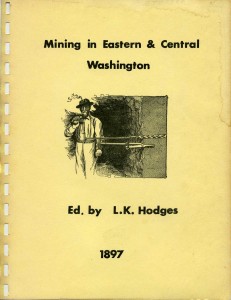
I have added a scanned copy of Mining in Eastern and Central Washington by L.K. Hodges, published in 1897 to this website. Hodges travelled the mining camps of Eastern Washington at the request of the Seattle Times and sent back stories that were compiled in this book. It includes diagrams of the workings of many mines, maps of their locations and descriptions of the mines. WARNING: This is a large file 100+ kb. If you have a slow Internet Connection, you may want to avoid it. I can print and bind a copy for you for $20.
New Field Trips
June 8th
Kinross Gold Milling Facility
363 Fish Hatchery Road, Republic WA
Tour starts at 9:30 AM
Meet at Kettle Falls Harvest Foods parking lot in time to START by 7:45 AM
July 11
White Stone Calcium plant
At big smokestack south of Chewelah
Start 9:00 AM
Wear hard shoes, bring hard hat if you have one. If you have extra hard hats, please bring them for others.
Meet are the plant
July 24
Kinross Buckhorn Mine Tour
Mine entrance east of Curlew
(I will get directions at the June 8th tour)
Tour starts at 9:30 AM at mine administration building
Meet at Kettle Falls Harvest Foods parking lot to leave by 7:00 AM
Any questions, give me, Bob Bristow, a call on 945-4375.
Map to McDermitt
There is a multi-day, multi-club field trip scheduled for June 20-24 to McDermitt Nevada and surrounding sites. Mike Shaw has prepared a map for the expedition. He writes: “Have people contact me by email so I can send them the following map and schedule: https://www.google.com/maps/d/
Schedule:
6/20/2015 Saturday All Day Travel to McDermitt, NV
6/21/2015 Sunday 8am Meet at the Large Group Campground and collect on the McDermitt Loop
6/21/2015 Sunday 7:15am Meet at the Say When Casino in McDermitt and collect on the McDermitt Loop
6/22/2015 Monday until 2 pm Free time to return to your favorite areas on the Loop to collect more of your favorite materials
2 pm until dusk Explore and collect at the Cordero Open Pit Mine and the Orange Agate area
6/23/2015 Tuesday 8am at Camping area, or Thunderegg collecting north of McDermitt, And/or go to the Amethyst Sage Site ($3/lb)
8:30 at McDermitt Casino
6/24/2015 Wednesday 9am Camping area Head back for home, with a stop a Glass Butte for Fire Obsidian and others. A stop at Hampton
9:30 at McDermitt Casino
Hampton Butte for petrified wood is also possible that day. Camping is available free at both
locations.
McDermitt Loop material Gary Green Agate(AKA Larsonite), Fortification Agate, Purple Cow Agate, Carnival Agate, Pet. Wood
Cordero Mine Lots of beautiful Red Agate, other agates, wonderstone and jaspers of all descriptons.
There is a deposit of Orange Agate nearby, also
Northwest Underground
At our meeting April 20 we voted to buy copies of Discovering Washington’s Historical Mines by Woodhouse, Jacobson and Pisoni. There is an ongoing Internet discussion by people who explore the mines written up in these books. You can reach it at https://groups.yahoo.com/neo/groups/NWUNDERGROUND/info
You may need to join Yahoo to see the content.
